Nuclear Sites Map 1.1
Free Version
Publisher Description
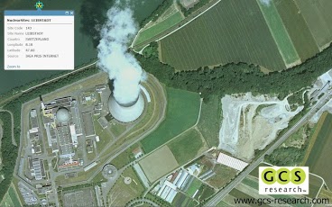
The Nuclear Sites Map App was developed by GCS Research, an award winning geospatial technology company based in Missoula, Montana. Map contains approximate buffered (50 and 100 km) locations of world nuclear plants. The data has not been verified against the nuclear regulatory commission for each country. The map contains data from Esri ArcGIS Online. Quaternary faults and fold data provided by the USGS.This map layer contains locations and information on faults and associated folds, in the United States, that are believed to be sources of significant earthquakes (those of magnitude 6 or greater) during the past 1,600,000 years. A fault is a fracture or zone of fractures in the Earth's crust, along which the blocks of crust have moved relative to one another; an earthquake is the result of such a movement. Folds are curves or bends in rock layers. The Quaternary Faults and Fold database contains information compiled by the Earthquake Hazards Program of the U.S. Geological Survey (USGS). The database describes faults and associated folds in the United States that are believed to be sources of earthquakes, greater than magnitude 6, in the past 1,600,000 years, and is intended to be an archive of historical (less than 150 years) and ancient earthquake sources. Nuclear site data from by the IAEA PRIS INTERNET, U.S. NUCLEAR REGULATORY COMMISSION, and FEDERATION OF AMERICAN SCIENTISTS. Contact GCS Research with your custom Smartphone development needs. www.gcs-research.comGCS Research provides our clients with advanced geospatial information technology, so they can achieve their strategic objectives. We deliver internationally recognized, award-winning solutions through an innovative commitment to the customer’s concept and project requirements. Building upon exceptional service and affordable, industry-leading tools, our success is measured by meeting and exceeding the exacting requirements of our customers.Our portfolio consists of connected "smart" applications and data systems, innovative extensions for industry-leading core platforms, and extensible, integrated Web services. We utilize a standards-based approach to propel next-generation advancements along leading software packages and data resources and help our customers achieve their objectives through a combination of experience, innovation, and commitment to excellence. By building upon the software and data technologies of our strategic partners in the industry, GCS Research cultivates end-to-end geospatial solutions at the height of GIS evolution. Using Service-Oriented Architecture (SOA) and Web service protocols, our clients easily access and share geographic and related content across distributed networks, removing historical barriers to decision-making, analysis, and collaboration. GCS clients include a blend of commercial and government organizations. We deliver a diverse range of geospatial applications, advanced research and development activities, and strategic consulting services. GCS focuses upon the communication, analysis, and exploitation of geospatial intelligence for a dynamic, high-performance user experience. Our success is measured by meeting and exceeding the exacting requirements of our customers.
About Nuclear Sites Map
Nuclear Sites Map is a free app for Android published in the Other list of apps, part of Games & Entertainment.
The company that develops Nuclear Sites Map is GCS Research. The latest version released by its developer is 1.1. This app was rated by 1 users of our site and has an average rating of 3.0.
To install Nuclear Sites Map on your Android device, just click the green Continue To App button above to start the installation process. The app is listed on our website since 2012-04-27 and was downloaded 6 times. We have already checked if the download link is safe, however for your own protection we recommend that you scan the downloaded app with your antivirus. Your antivirus may detect the Nuclear Sites Map as malware as malware if the download link to com.gcsresearch.nuclearsites is broken.
How to install Nuclear Sites Map on your Android device:
- Click on the Continue To App button on our website. This will redirect you to Google Play.
- Once the Nuclear Sites Map is shown in the Google Play listing of your Android device, you can start its download and installation. Tap on the Install button located below the search bar and to the right of the app icon.
- A pop-up window with the permissions required by Nuclear Sites Map will be shown. Click on Accept to continue the process.
- Nuclear Sites Map will be downloaded onto your device, displaying a progress. Once the download completes, the installation will start and you'll get a notification after the installation is finished.
